On this page
- Begin with the report date
- Separate the different kinds of date
- Identify the information type
- Ask what the geographic unit represents
- Read the legend before interpreting the color
- Treat missing information as an open question
- Use official flood information carefully
- Compare versions without inventing a cause
- Route the question to the right professional
- Keep a source log you can reuse
- Sources and reference material
A property hazard report may contain information from several sources, each with its own date, geography, and purpose. The day you generate the report does not necessarily mean every underlying record was created that day. To use the information well, ask what each result describes, when its source was updated, and how directly it relates to the property.
This is a reading skill, not a reason to dismiss useful data. A dated map can still be the applicable effective map. A historical record can provide important context. A missing result can show that a question needs another source. The key is to preserve those distinctions instead of flattening everything into a single current verdict.
Hazard Clarity’s explanation of free home hazard reports introduces the broader process. This guide helps you organize source dates, map scope, and unanswered questions when reading any property report. It does not assume that every platform displays the same fields or uses the same methodology.
Begin with the report date
Record when you requested or received the report and which property it describes. If you save another version later, keep both with clear filenames. That lets you compare what was available at each point without confusing an older copy with the most recent one.
The report date is a useful administrative fact. It may reflect when a service assembled or retrieved information, but it should not be used as a substitute for source dates. Look for source notes, dataset descriptions, effective dates, and links. If a detail is not shown, ask the provider what can be confirmed.
Avoid assuming that a fresh-looking design means fresh underlying data. Presentation and provenance are different. A clean summary can help you understand information while still relying on records with their own update schedules. Keep the report as an organizing document and follow its important results back to the source appropriate for the decision you need to make.
Separate the different kinds of date
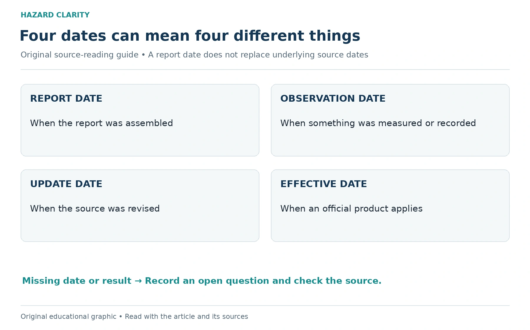
Several dates may appear in a research file. A publication date identifies when material was issued. An update date may identify a revision. An effective date can identify when an official product applies. An observation date identifies when something was measured or recorded. These dates answer different questions.
A report generated this week might reference a map with an older effective date and an inspection conducted last month. That combination is not inherently inconsistent. Ask which date matters for each use. For a regulatory map question, effective status may matter; for a building’s current condition, the timing and scope of a physical evaluation may be more relevant.
Write the date’s label beside the date. A worksheet entry saying only “2024” is ambiguous. An entry saying “inspection performed May 2024” is more useful, especially if a later renovation occurred. Do not silently fill missing dates with the date you opened the document. Mark them unknown and request the original record where needed.
Identify the information type
A historical observation, an official mapped designation, a modeled estimate, and a current physical finding are different information types. Each can contribute to research, but they should not be described as interchangeable. Ask what process produced the result and what question it was intended to answer.
For example, a historical event record may show that something occurred in an area. It does not necessarily establish damage to a particular building. A modeled result may describe estimated exposure under defined assumptions. It should not be presented as an observation of the home today or a prediction of a specific event on a specific date.
A useful summary preserves these distinctions in ordinary language. Record the information type in your worksheet and add the source’s own explanation. If the type is unclear, that is an appropriate question for the provider. The goal is to understand the evidence well enough to route the next question, not reverse engineer a methodology from a colored label.
Ask what the geographic unit represents
An address can be connected to information at several scales: a point, parcel, neighborhood, county, or broader region. Confirm the unit used for the result. A county-level record can provide useful context without describing every parcel in the county identically. A regional pattern should not be converted into a property-specific finding.
Check whether the address marker falls where you expect. If the home has several structures, identify the building you are considering. Rural parcels and irregular street addresses can require extra care. A marker is a locator; it is not necessarily a surveyed boundary or a building footprint.
Keep the geographic scope with the result when sharing it. “The county record shows this pattern” is clearer than “this house has this condition” when the evidence is regional. If the purchase question needs site-specific analysis, ask an appropriate professional what additional records or evaluation are required. A more detailed zoom level cannot create information that the source does not contain.
Read the legend before interpreting the color
Colors, bands, and labels depend on the product’s legend and methodology. Similar colors on two websites may represent different categories. Keep the legend with screenshots and record the layer names. A cropped image can lose exactly the information needed to understand what the display means.
If you compare two sources, compare their definitions before their colors. One may show an official designation while another shows a modeled estimate. The disagreement may be about purpose, timeframe, or scale rather than an error. Ask what each source is designed to represent and how the categories are established.
Avoid building your own universal rating from unrelated labels. Combining a regional hazard band, an inspection finding, and an insurance quote into one score can conceal important differences. A question-based worksheet is usually more useful for a consumer: what does this record show, what does it leave open, and who can address that gap?
Treat missing information as an open question
A blank field, unavailable source, or failed lookup does not establish that exposure is absent. It may reflect coverage limits, an address-matching issue, an unavailable service, or another gap. Ask the provider what the status means before turning it into a property conclusion.
Look for an explanation in the report and preserve it. If the reason is not shown, record the field as unresolved and identify another appropriate research path. That might involve an official map, a local office, or a qualified specialist, depending on the topic. Do not invent a value to make a comparison sheet look complete.
When comparing homes, distinguish a documented low category from an unavailable result. Otherwise, the property with less information may appear preferable simply because its record is incomplete. Accurate unknowns improve decisions. They show where additional work is needed and keep the research from rewarding missing data with an unsupported assurance.
Use official flood information carefully
Flood mapping offers a concrete example of why status and date matter. FEMA distinguishes effective mapping from preliminary products that are subject to change. Its products can also include map amendments or revisions. The appropriate official records should be checked for the property rather than assuming the first map image tells the whole story.
HC’s FEMA flood-zone guide can help you start. Save the source, map status, relevant panel, date, and legend. Ask the local floodplain administrator which records apply when you need a transaction-specific explanation. A preliminary map may be useful information without automatically replacing the effective product.
Do not use a map date to infer that no flooding occurred afterward or that a home’s condition is unchanged. The designation, event history, and building condition are separate questions. Keeping them separate makes the file easier for a local official, inspector, or insurance professional to interpret within their own scope.
Compare versions without inventing a cause
If a report result changes, first confirm that the property and comparison fields are the same. Then check dates, source names, definitions, and status notes. A change might involve new information, a different source, or a correction, but you should not decide the cause without evidence.
Save the older and newer files and ask the provider what changed. Include the relevant section rather than sending only a color or score. A clear question identifies the address, report dates, result, and decision you are trying to make. That gives the provider a better basis for explaining the difference.
Keep your notes neutral while the question is unresolved. Do not assume the property suddenly became more hazardous or that one version is wrong. If the difference affects an active transaction, notify the appropriate adviser and obtain the needed source confirmation before relying on a conclusion. A version comparison is a research task, not a diagnosis.
Route the question to the right professional
An official map-status question belongs with the relevant source or local authority. A physical-condition question belongs with an inspector or appropriate specialist. A policy interpretation belongs with a licensed insurance professional. A legal obligation belongs with an appropriate legal adviser. The report can help you identify the question without replacing those roles.
Read how hazard reports and home inspections differ when assembling a purchase file. Give each professional the source record, your actual question, and the decision deadline. Avoid asking for a broad assurance that the property is safe when a narrower, evidence-based answer is possible.
Record the response with its scope and date. An informal conversation can guide your next step, but a technical report or official document may be needed for the specific decision. Ask what documentation is appropriate. Good routing turns a confusing label into a useful action and prevents the wrong professional from being expected to answer everything.
Keep a source log you can reuse
Build a compact log with fields for the question, source, information type, geographic scope, date label, result, limitation, and next step. Keep the original links and files alongside it. Use plain descriptions and mark unknowns openly. The log should make the research easier to explain, not reproduce every detail in the report.
Update the file when you receive a new record or a meaningful change occurs. Preserve older versions when they help document the history. A purchase, renovation, renewal, or new official notice can be a useful moment to review whether the relevant information still answers your question.
Start a property report at Hazard Clarity and read it as a set of sourced questions. The strongest takeaway is an understanding of what each record can establish and what needs another step. Dates, scope, and missing information help you use the report accurately and discuss the property with more confidence.
Sources and reference material
Kentucky Energy and Environment Cabinet Find Your Flood Zone • Official explanation and links for comparing FEMA effective and preliminary products; no Kentucky tag because state-specific rules are not discussed. Accessed October 2 2026.
See this property’s own hazard picture.
Check an address