On this page
- Read the official information in its proper scope
- Expand the record beyond the house footprint
- Define the inspection boundary before relying on it
- Ask a qualified specialist an answerable question
- Treat drainage work as a coordinated site question
- Review the road and access responsibilities
- Keep the insurance conversation specific
- Turn the findings into a usable ownership file
- Sources and reference material
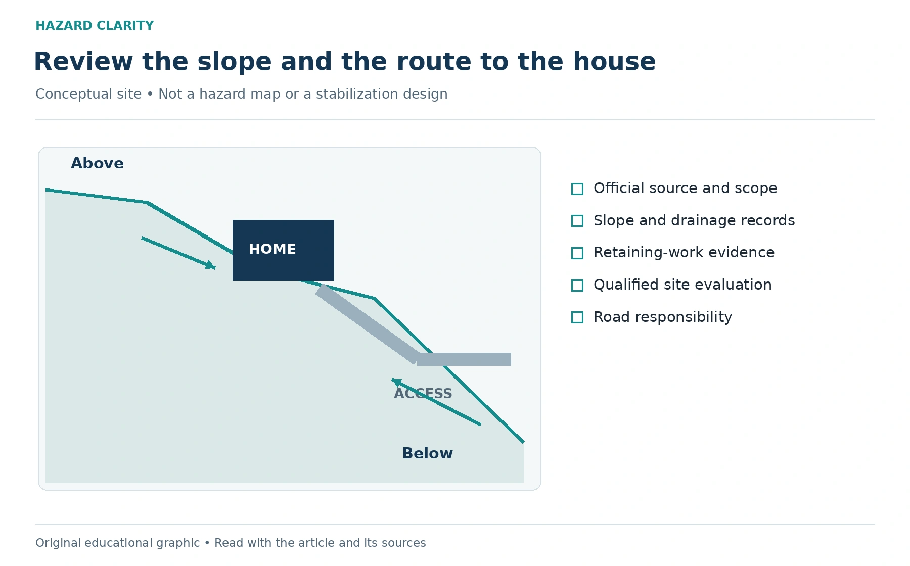
A North Carolina mountain home often asks you to look beyond the building itself. The slope above the house, the ground below it, drainage paths, retaining structures, and the road leading in can all belong in the purchase review. A level interior floor or a clear view during a showing cannot answer every question about the surrounding terrain.
The useful first step is to define the property question rather than label the site from a photograph. You may need to understand an existing slope repair, a retaining wall with incomplete records, or the relationship between an uphill drainage area and the driveway. Each concern calls for information with a specific scope and an appropriate professional response.
North Carolina’s Geological Survey provides landslide and geologic-hazard resources that can help begin this research. Those resources support inquiry; they do not replace an evaluation of the property. This guide focuses on a buyer’s slope and access file, connecting official information to records, inspection limits, professional follow-up, and an ownership plan without trying to forecast an event from a map pin.
Read the official information in its proper scope
North Carolina DEQ’s landslide resources include mapped information and educational explanations. Begin with the official source, confirm the location, and read the legend and accompanying description. Record what kind of information is displayed and whether it represents documented events, mapped features, or another product. Do not assume all layers answer the same question merely because they appear in one viewer.
A point near a property should prompt you to understand its meaning, not to assign the house a damage history. A result with no nearby point should not become proof that the property has no slope concern. The careful question is what the source includes, what its coverage is, and what additional local or site-specific information the Geological Survey or another qualified provider recommends.
Save the source reference and review date along with the result. If the address does not match the intended property, resolve that before using the information. HC’s guide to checking natural-disaster risk before buying provides a broader starting framework, while the North Carolina slope file should retain the exact local questions that need follow-up.
Expand the record beyond the house footprint
Ask for surveys, site plans, drainage plans, and records of work above or below the building where they exist. A buyer may receive extensive interior renovation receipts but little information about site work. Request the records for retaining walls, grading, drainage changes, and earlier evaluations separately so that those subjects are not lost in a general maintenance folder.
Ask the seller which earlier observations or repairs are documented and where they occurred. An invoice for driveway work may describe resurfacing without addressing the underlying slope. A wall repair receipt may identify materials without an engineering scope. Read each record for what it actually establishes, then list the questions it leaves unanswered rather than using its existence as proof of a complete solution.
Include features outside the parcel when they raise a relevant question, while respecting access boundaries and ownership. An uphill road or adjoining drainage feature may be visible but outside the seller’s control. Ask the appropriate local authority or professional what records are available and who is responsible for the feature. Do not infer responsibility solely from where water appears to travel.
Define the inspection boundary before relying on it
A general home inspection can describe observations within its contracted scope and recommend further evaluation. Ask whether the inspection addresses retaining structures, drainage observations, or access features, and what remains outside the service. A buyer should know the difference between a visible observation and a specialized geotechnical assessment before making decisions from the report.
HC’s report and inspection comparison is useful for keeping those services distinct. A location report helps organize hazard research. A home inspection addresses the building and other agreed components. A specialist may evaluate a slope or site question. None should be described as covering the work of the others unless the actual scope supports that statement.
If access is limited, ask the inspector to identify the affected area and why it could not be observed. Heavy vegetation, locked access, weather, or site conditions may restrict the review. Keep that limitation attached to the question. A section without findings can mean something was not evaluated, which is very different from a documented finding that answers the concern.
Ask a qualified specialist an answerable question
North Carolina DEQ notes that successful long-term stabilization of a slope above or below a home often requires a geotechnical engineer experienced with the area’s soil and rock. For a buyer, that supports asking whether a geotechnical evaluation is appropriate when slope concerns remain. It does not mean a general content checklist can determine the necessary design or certify a repair.
Describe the intended question to the provider before booking. For example, you may need an evaluation of a documented retaining-wall repair and the site conditions relevant to an addition. Ask what records, access, investigations, or other services are needed to address that scope. Confirm the written deliverable and timing, especially when a purchase agreement has its own inspection and response deadlines.
Ask the provider to identify observations, assumptions, limitations, and recommendations separately. If the report calls for additional work, request enough detail to understand who should perform it and what would close the question. A statement that further investigation is recommended belongs on the follow-up list; it should not be paraphrased as either a guarantee of failure or an assurance that the site is acceptable.
Treat drainage work as a coordinated site question
A buyer may encounter a simple proposal to redirect water or add a drain. Before treating that proposal as a slope solution, ask the relevant professional whether it is suitable for the site and what permissions or approvals apply. The point is to connect proposed work with the evaluation, not to select an installation from a generic article.
Request written scopes for drainage and retaining work, including the locations, assumptions, exclusions, and responsibility for permits. Ask how the contractor will document changed conditions discovered during the job. If multiple providers are involved, identify who coordinates the work and who receives the completion records. Otherwise, an owner may end up with invoices that do not explain whether the original question was resolved.
Maintain a clear boundary between buyer observations and professional conclusions. You can record that water was visible beside a driveway on a particular date. You cannot establish the cause or adequacy of the drainage system from that note alone. Passing the observation and its context to a qualified provider is the productive next step, particularly when slopes and adjoining properties are involved.
Review the road and access responsibilities
The route to the property belongs in the review because ownership involves more than the building. Ask whether the road is public or private, who maintains it, and which written agreements apply. Request available maintenance records and any documented interruption history. A scenic driveway can still leave practical questions about responsibility, recurring work, and access during severe weather.
If a private agreement is involved, have the appropriate legal or real estate professional explain its effect rather than relying on an informal description. Ask who can authorize work, how decisions are made, and what costs or duties the buyer is taking on. Keep the agreement with the site records so an ownership task does not disappear when the closing documents are filed elsewhere.
Discuss emergency access questions with the relevant local authority when necessary. Do not test a questionable road or slope by driving into an unsafe condition. A buyer’s site file should support safe planning through records and qualified guidance. During an actual emergency, official directions and immediate safety needs take precedence over completing a purchase checklist.
Keep the insurance conversation specific
Provide the insurance professional with the documented site concerns and completed evaluations relevant to the application. Ask how the proposed policy addresses the scenarios being discussed and which exclusions, endorsements, or other policies may be relevant. The word landslide in a general conversation does not establish the cause of damage or the way a particular policy would respond.
Use HC’s insurance questions before buying to prepare the discussion, then ask for references to the actual policy documents. Keep any requests for additional information or work in writing. If coverage depends on a stated property condition, verify that the description given to the insurer accurately reflects the records rather than a simplified seller summary.
Financing and insurability also deserve separate tracking. A lender’s acceptance of documents is not a geotechnical assessment, and a technical report is not an insurance binder. Put the responsible person and deliverable next to each open item. That makes it easier to see whether the remaining question affects the purchase decision, the coverage process, or work planned after ownership begins.
Turn the findings into a usable ownership file
Consider an illustrative buyer who receives an old drainage invoice, an inspection recommendation about a retaining wall, and a map reference showing a nearby documented landslide. Those three records do not establish one combined conclusion. The buyer should preserve their distinct scopes and ask a qualified provider which property evaluation is needed to connect the relevant information.
After the review, retain the specialist’s report, contractor scope, permits where applicable, and completion documentation. If there are monitoring or maintenance recommendations, assign them to a person and date using the provider’s instructions. A task marked complete should have supporting evidence; a task waiting for evaluation should remain visible as an open item.
Begin broader regional research with HC’s North Carolina resources. Then build a file that describes this slope, this access route, and this home. The strongest purchase review leaves you with understandable evidence and clear next questions, giving both the buyer and the future owner a more practical foundation for decisions about the property.
Sources and reference material
North Carolina DEQ Geologic Hazards and Landslides • Official geological research resources. Reviewed October 3 2026.
North Carolina DEQ Recognizing Landslides • Qualified geotechnical assistance for slope stabilization. Reviewed October 3 2026.
See this property’s own hazard picture.
Check an address