On this page
- Separate flooding from erosion at the beginning
- Locate the parcel in the official shoreline resources
- Review the existing structures and future projects together
- Ask for a survey and a usable property history
- Choose the next professional question carefully
- Keep insurance and financing questions independent
- Turn an illustrative purchase into an organized decision
- Maintain the file after closing
- Sources and reference material
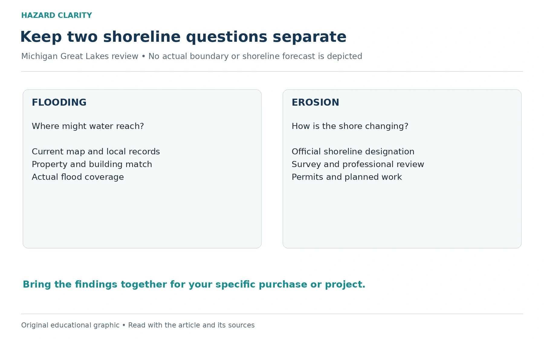
A Michigan Great Lakes home can offer a remarkable view while asking two very different water questions. One concerns flooding: where water may reach land or buildings. The other concerns shoreline erosion: how land at the shore changes or recedes. A flood-map result should not be used as a complete answer about shoreline stability, and a shoreline designation should not be treated as an insurance coverage decision.
For a buyer, the practical challenge is to connect the official information with the property’s survey, improvements, earlier work, and future plans. You may be considering a porch addition, a replacement septic system, or repairs to an existing structure. Those plans can make permit and setback questions important even when the listing emphasizes only the house and the view.
This review focuses on Michigan property along the Great Lakes. It does not extend Great Lakes shoreline rules to every inland waterfront home. The objective is to build a shoreline file that identifies the documents, unresolved questions, and appropriate people needed for the specific parcel. It offers a research process rather than a forecast of how far the shoreline will move.
Separate flooding from erosion at the beginning
Michigan’s Department of Environment, Great Lakes, and Energy, or EGLE, maintains information about designated high-risk erosion areas. Its guidance explains that shoreline recession rates can change with water levels and coastal conditions. A designation and the associated information are useful research inputs, but they do not provide a personalized promise about future conditions at a particular house.
Keep your flood-map review in a separate section of the file. HC’s FEMA flood-zone checking guide can help you begin that work. Record the effective map, the property location, and any questions for the local floodplain administrator. Then create a second section for shoreline information so that a favorable answer in one section does not silently close the other.
This separation also improves conversations with professionals. Instead of asking whether a waterfront home is safe, ask what the flood information shows and what the shoreline records show. Each question can lead to a different document or evaluation. The result is a more precise discussion of uncertainty and options, especially when the buyer is comparing two properties with different site conditions.
Locate the parcel in the official shoreline resources
Use EGLE’s official high-risk erosion maps and instructions rather than relying on a screenshot from the listing. Confirm that the address search leads to the correct parcel and lake frontage. A map image without its legend, source, and date is difficult to evaluate later. Save the relevant reference information and note whether the result requires clarification from the agency or local officials.
Do not draw your own setback from an unlabeled distance on a consumer map. Ask the appropriate official which designation applies and which measurement method or property records are needed for your question. The purpose of a buyer’s map review is to identify follow-up, not to replace a professional survey or an agency determination about proposed work.
If the online information appears inconsistent with a seller’s records, preserve both and ask for an explanation. A renamed street, changed parcel configuration, or an older document may complicate matching. Treat the mismatch as an open item. It is easier for an official to respond to two clearly identified records than to a general statement that the internet says something different.
Review the existing structures and future projects together
EGLE states that construction of structures on designated high-risk erosion area parcels can require a permit regardless of how far the project is from the lakeshore. Its examples include houses, additions, and septic-system work. That makes a buyer’s intended project relevant early in the review, rather than an item to investigate only after ownership changes.
Describe the project you actually want to undertake. A request about replacing a deck may need different details from one about an addition or substantial reconstruction. Ask EGLE and the local zoning administrator which approvals and records apply. Do not assume a prior owner’s approval transfers to new work or that one permit answers every state and local question.
Gather earlier permits, site plans, conditions, and completion records for existing improvements. Identify what each document covers and whether the built work appears to match the description, leaving technical interpretation to the appropriate provider. If documentation is missing, ask where records are maintained and what the buyer can obtain. An attractive improvement still needs its own paper trail.
Ask for a survey and a usable property history
A survey may help establish parcel boundaries and the location of buildings or other features, depending on its scope. Ask the surveyor whether the existing document is suitable for the current shoreline question and proposed project. Do not treat any sheet labeled survey as a complete assessment of shoreline change or as a current site plan.
Request dated photographs and accounts of earlier shore conditions, repairs, or protective work. Organize these as historical observations rather than a forecast. Ask when the images were taken, what location they show, and what work occurred afterward. A photograph with a broad lake view may not show the relevant part of the bluff or the relationship to the building.
If earlier protective structures or shoreline work are present, request the contractor scope, permits, and maintenance information. Ask a qualified provider what condition evaluation is appropriate and what limitations the work has. Avoid interpreting the existence of a wall or other feature as proof that erosion has been eliminated. The buyer needs to understand responsibilities and evidence, not simply identify a visible structure.
Choose the next professional question carefully
A shoreline evaluation should be commissioned with a specific purpose. Ask whether the provider has appropriate experience with Great Lakes coastal conditions and what the report will address. Possible questions concern the present site, existing improvements, proposed construction, or information needed by permitting officials. Confirm which of those questions are included rather than relying on a broad service name.
Provide the official map references, survey, historical photographs, and project description before the evaluation. Ask the provider to identify assumptions, access limitations, and additional records needed. A useful report makes its scope visible. If it recommends another specialist or an agency conversation, retain that recommendation as an unresolved item with a responsible person and follow-up date.
The distinction in HC’s hazard report versus inspection article applies here as well. Location information can help direct inquiry, while a site evaluation addresses a particular professional scope. Neither should be stretched into a guarantee about the entire property. Each should tell you what is known and what remains outside the evaluation.
Keep insurance and financing questions independent
Share the relevant property information with your insurance professional and ask how the actual proposed policies address the water and earth-movement scenarios you are discussing. Request identification of applicable coverage, exclusions, deductibles, and any information needed for underwriting. A shoreline permit or assessment does not establish insurance coverage by itself.
HC’s flood coverage explainer can help you frame the flood portion of that conversation. For shoreline erosion or damage involving land movement, ask the professional to address the specific policy wording rather than extending the flood explanation to every shoreline event. Keep written responses alongside the documents used in the discussion.
If financing is involved, ask the lender which records it requires and how it evaluates them. A lender’s document request is a separate workflow from your own property review. Completing the request may support the loan process without resolving every ownership concern. Do not let an administrative approval substitute for reviewing maintenance, future construction, access, or the remaining site questions.
Turn an illustrative purchase into an organized decision
Imagine a buyer considering a Great Lakes home with an older shoreline improvement and plans for an addition. The seller provides a permit for the earlier work and describes the shore as stable. The buyer should preserve that statement and permit, then ask what the permit actually authorized, what maintenance records exist, and which current approvals would apply to the addition.
Next, the buyer matches the parcel in official shoreline resources, reviews the survey with the appropriate provider, and commissions any evaluation needed for the stated project. The insurance professional receives the facts relevant to the proposed policies. Each response goes into the appropriate section, so a favorable insurance quote does not become an assumed construction approval.
The decision can then reflect more than whether the existing house looks appealing. The buyer can compare documented responsibilities, proposed work, unresolved questions, and the effort needed to obtain answers. This method does not dictate whether to buy. It makes the tradeoffs visible enough to discuss with the buyer’s real estate, legal, technical, and insurance professionals.
Maintain the file after closing
An owner’s shoreline file should remain understandable as new work and observations are added. Keep permits, professional reports, photographs, contractor records, and agency correspondence with a simple index. Record which question prompted each document. If a provider specifies recurring review or maintenance, put that instruction on the ownership calendar with the source attached.
When you consider a new project, return to the applicable officials and current records. Earlier research may not answer a changed proposal. Likewise, a new observation should be documented without treating it as proof of a particular mechanism. A concise account of what changed, where it occurred, and when it was observed gives the next provider a better starting point.
Use HC’s Michigan flood resources for broader water context, while retaining Great Lakes erosion as its own property question. A useful waterfront review connects official information, site evidence, proposed use, and actual policy terms. Keeping those parts distinct helps you make a more informed decision and leaves the next owner with a clearer record of the property.
Sources and reference material
Michigan EGLE High Risk Erosion Areas • Great Lakes designation and construction-permit context. Reviewed October 3 2026.
Michigan EGLE High Risk Erosion Area Maps • Official parcel research starting point. Reviewed October 3 2026.
See this property’s own hazard picture.
Check an address