On this page
- Identify the question before selecting the record
- Read the map as a map
- Understand the certificate’s building focus
- Start by looking for an existing record
- Check that the document matches today’s building
- Keep insurance pricing distinct from map reading
- Ask local officials about local requirements
- Do not confuse an elevation certificate with a map change
- Use a hypothetical file review
- Give the reviewer the complete question
- Turn the records into a decision file
- Sources and reference material
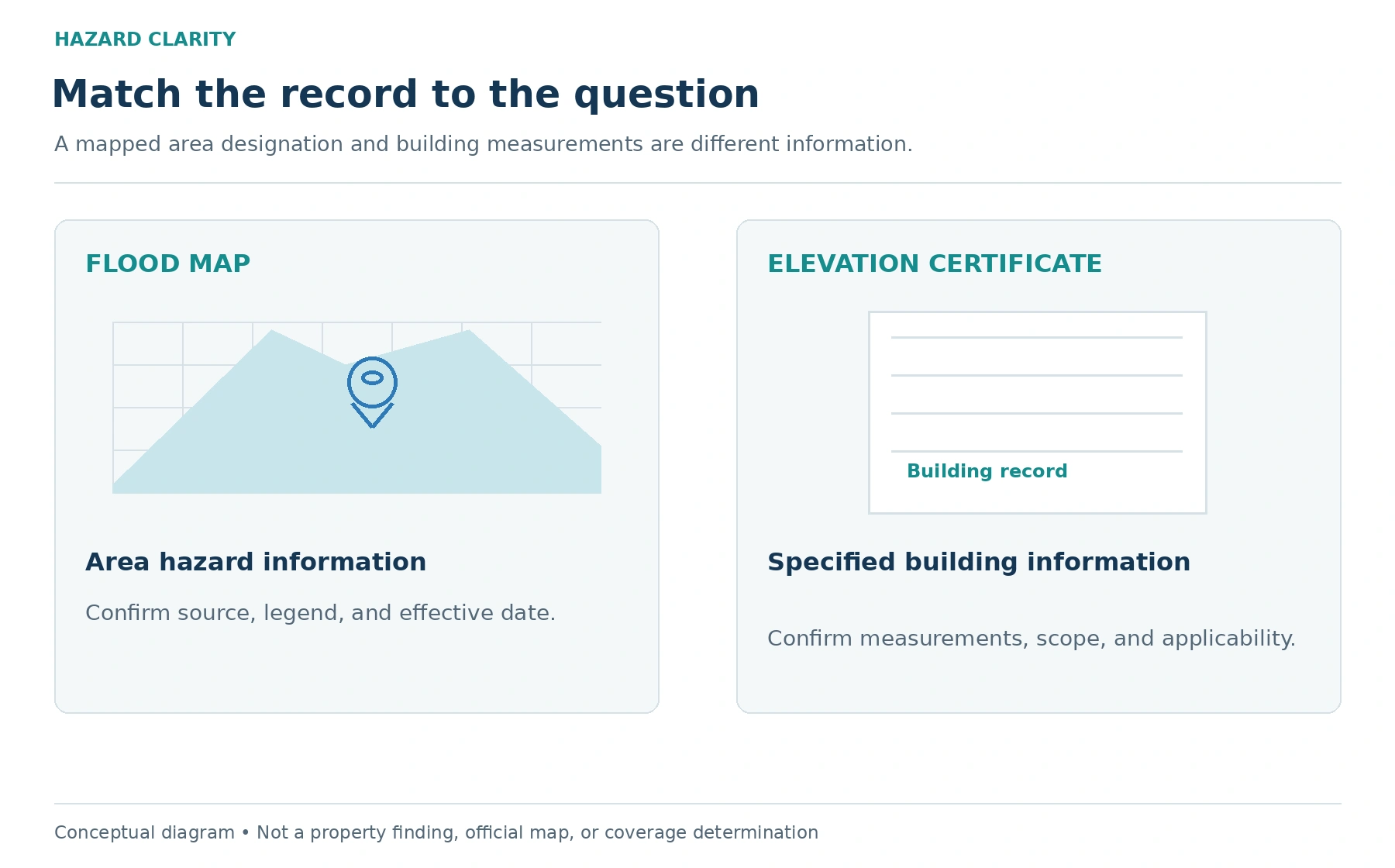
A flood map and an elevation certificate can both help you understand a property, but they are different records. The map provides mapped flood hazard information for an area. The certificate records specified information about a particular building, including elevation-related details. Reading them together can produce better questions than relying on either document alone.
The distinction matters when a listing says a home is outside a high-risk zone, raised above flood level, or eligible for a particular insurance price. Those statements may refer to different documents and different purposes. Ask what evidence supports each claim before treating them as equivalent conclusions.
Start with HC’s guide to checking a FEMA flood zone. Then use this article to organize the map, building records, local review, and insurance questions for the actual address.
Identify the question before selecting the record
If your question is which mapped flood hazard designation applies, start with the effective map and associated official information. If your question is how a building’s documented elevations relate to a relevant reference, an elevation certificate or other qualified survey information may be part of the answer.
If your question concerns a lender requirement, local compliance, a map change, or an insurance proposal, identify that purpose explicitly. The person responsible for one decision may need different documents from the person responsible for another. A general property conversation becomes much clearer when everyone knows which determination is being requested.
Write the question at the top of your research notes. For example, “confirm effective mapped designation” and “locate existing building elevation records” are actionable tasks. “Is this home safe from water?” is too broad for either document to answer as a guarantee.
Read the map as a map
Locate the property carefully and keep the map panel, effective date, legend, and relevant designation with your notes. Check whether you are viewing effective information or another kind of product, such as preliminary mapping. If you are unsure, ask the local floodplain manager to identify the applicable official record.
Do not assume that a marker placed on a web map precisely identifies every structure or boundary. Ask how the building footprint relates to the mapped area when the property lies near a boundary. A parcel can contain several features, and the location of a single address marker may leave important details unresolved.
Preserve the source rather than keeping only a cropped image. A screenshot without a legend or date can lose the context needed for later review. The goal is to retain enough information that a qualified person can understand what you looked at and verify it.
Understand the certificate’s building focus
FEMA’s flood insurance program explains that an elevation certificate includes a home’s location, characteristics, and first-floor height information. It is a building record, not a complete account of every way water could affect the property. Its value depends on what was measured and documented.
Ask a qualified professional to explain the relevant sections and measurements. Do not compare numbers without confirming their reference systems and meaning. Ground height, a floor measurement, and a mapped flood elevation may serve different purposes; they should not be combined casually to produce your own compliance conclusion.
An elevation certificate can contribute to local review and insurance discussions. It does not automatically change a mapped designation or guarantee a lower premium. Ask the authority or insurer what process and additional information are required for the particular decision you need.
Start by looking for an existing record
Ask the seller whether an elevation certificate is available and request the complete document. Check with the local floodplain manager, who may work within a city or county building, permitting, engineering, or land-use office. FEMA identifies that local contact as a useful starting point for locating a certificate already on file.
If a copy exists, save all pages, attachments, photographs, and certifications that accompany it. Record where you obtained it and whether it is the same version provided by the seller. Missing sections can prevent someone from understanding the document’s scope or how the information was prepared.
If no certificate is available, ask whether obtaining one would help with your specific question. Confirm the appropriate qualified professional, required scope, timing, and cost before ordering it. The absence of a certificate should remain an information gap until the relevant person explains what it means for your situation.
Check that the document matches today’s building
Compare the address, building description, date, and available photographs with the property being purchased. Ask whether an addition, enclosure, reconstruction, or other change occurred after the document was prepared. An older record may still be useful, but its applicability deserves review when the building has changed.
Do not reject or accept a certificate solely because of its age. Instead, ask the professional or local authority whether it remains adequate for the stated purpose and whether an updated record is needed. The answer depends on the document, building, and decision rather than a universal expiration assumption.
Keep building permits and completed-work records available during that conversation. They can help explain what changed and when. If the current layout differs from the paperwork, record the discrepancy and ask how it should be resolved before relying on the document.
Keep insurance pricing distinct from map reading
Most homeowners do not need an elevation certificate simply to obtain flood insurance, according to FEMA’s current consumer guidance. Specific local compliance questions can still arise, and a certificate may help identify available discounts. Ask the flood insurance agent what is needed for this home and this proposal.
Request quotes using accurate property information and ask which inputs remain unverified. If an elevation document is supplied later, ask whether the proposal changes and why. Do not assume that a particular mapped designation produces a universal premium or that the certificate alone sets the price.
For context, review HC’s flood insurance article for homes outside high-risk zones. Then compare the actual coverage limits, deductibles, exclusions, effective dates, and conditions rather than focusing only on the quoted annual cost.
Ask local officials about local requirements
A local floodplain manager can help identify the relevant map, available records, and applicable local review process. Bring a precise question and the complete documents. Ask whether the information you have is sufficient for the proposed use or whether additional professional work is needed.
If you plan to renovate, add space, enclose a lower area, or replace major equipment, describe that plan before purchase where possible. The suitability of a building for your intended work cannot be determined from a general hazard map alone. Local permitting and floodplain requirements need their own review.
Keep the response tied to the proposed project and date. A conversation about the current building is different from permission for future work. Ask what further application, documentation, or approval would be needed rather than treating informal guidance as a completed permit.
Do not confuse an elevation certificate with a map change
If someone claims the property has been removed from a mapped high-hazard area, ask for the official determination and supporting records. An elevation certificate may support a process, but it is not itself the same document as a completed map-related determination. Have the relevant authority or lender explain the status.
Ask whether the determination addresses the land, a particular structure, or another defined scope. Keep that scope visible when reviewing the purchase. A broad verbal description can lose important distinctions about which part of the property was actually considered.
If the seller provides only an application or pending correspondence, label the status accurately. Pending review is different from an issued decision. Discuss the unresolved matter with the appropriate transaction professionals before assuming a future outcome will arrive by closing.
Use a hypothetical file review
Imagine a buyer who receives a flood map screenshot and an older elevation certificate for a home with a later addition. The screenshot lacks an effective date. The certificate appears to describe the original building, but the buyer cannot tell whether the addition changes its usefulness.
The buyer obtains the complete effective map information, asks the local floodplain manager about available records, and has the certificate’s scope reviewed by an appropriate professional. The insurance agent then explains what information is needed for the proposal. Each question goes to the person responsible for that answer.
The result may include confirmed facts and remaining uncertainty. That is still better than declaring the property low risk from one screenshot. This example illustrates a research workflow; it does not describe an actual property, map determination, or insurance outcome.
Give the reviewer the complete question
When requesting professional help, explain whether you need an insurance discussion, local compliance review, intended-project advice, or clarification of the effective map. Providing the purpose alongside the complete documents helps the reviewer identify the appropriate service. Ask for the response to distinguish confirmed findings from further work that remains necessary.
Turn the records into a decision file
Keep the effective map source, complete certificate, relevant local correspondence, building records, and insurance proposals in one folder. For every document, record the property, date, purpose, and any limitation you have been told about. Add a short list of unresolved questions with a responsible contact and deadline.
Before closing, ask whether the outstanding questions affect your purchase rights, proposed coverage, intended work, or budget. Your real estate and other transaction professionals can help connect those issues to the actual agreement. Do not let a document collection substitute for understanding what remains undecided.
For your next step, identify whether you need mapped hazard information, building elevation information, or a particular official determination. See how Hazard Clarity works to organize location context, then obtain the property records and qualified interpretation that fit the question.
Sources and reference material
FEMA National Flood Insurance Program — Elevation certificates • Reviewed October 2, 2026
FEMA — Map Service Center • Reviewed October 2, 2026
Sources support the article’s factual foundations; the research workflow, worksheets, and hypothetical examples are original editorial guidance. Confirm current requirements and policy terms for the actual property before relying on a transaction-specific conclusion.
See this property’s own hazard picture.
Check an address