On this page
- A shared neighborhood is only the starting point
- Elevation can differ over a short distance
- Drainage follows the actual site
- Flood maps do not always divide properties neatly
- Building details create a separate layer
- Vegetation and nearby features vary by parcel
- Access matters alongside the building
- Different reports can describe different things
- Build a fair comparison between homes
- Ask about records rather than reassurance
- Turn differences into useful next steps
- Sources and reference material
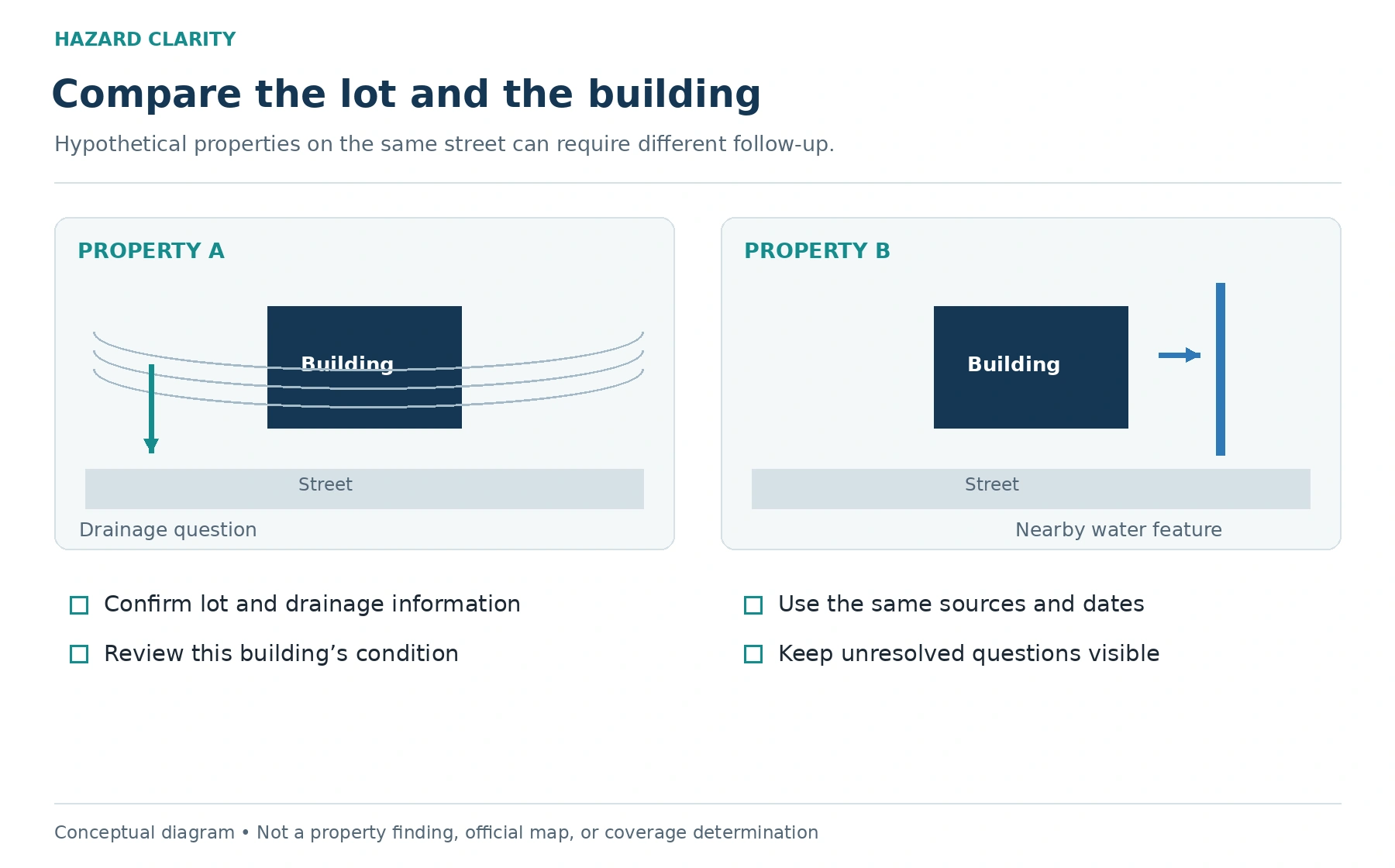
Two homes can share a street, school district, and nearly identical floor plan while presenting different property questions. Neighborhood context is useful, but it does not describe every lot, building, or access route. Small differences in elevation, drainage, vegetation, construction, and maintenance may change what deserves a closer look.
That does not mean one home should automatically be labeled better or worse. It means an address deserves its own review. The same principle applies when you already own a home: your neighbor’s experience can be informative without being a complete description of your property.
Start with HC’s guide to checking natural-disaster risk before buying. Then use the factors below to move from a neighborhood impression to a more specific set of questions about the home you are considering.
A shared neighborhood is only the starting point
A subdivision name can make homes feel more alike than they are. Houses may have been built in different phases, on different terrain, with different drainage connections. A road can sit above one group of lots and below another. A creek or wooded area may touch only part of the neighborhood.
Look at the individual parcel and building rather than stopping at the neighborhood label. Ask where water travels, which exterior features require maintenance, and how you reach the property during ordinary and unusual conditions. These are research questions, not conclusions about future damage.
A regional hazard summary can help identify a topic worth exploring. It usually cannot resolve every lot-level difference. Use the broad picture to decide what to examine next, then seek the records and professional observations relevant to the specific address.
Elevation can differ over a short distance
Two lots that appear flat from the street may have different relationships to nearby roads, drainage channels, or water. The first floor, garage, basement, and mechanical equipment may also sit at different levels. A slight change in the visible landscape can be difficult to evaluate reliably without appropriate information.
If elevation is important to your question, ask what source establishes it. A map estimate, survey measurement, and casual visual impression do not carry the same meaning. You may need a qualified survey professional or local floodplain official to explain a particular document.
Do not use a street-view image to declare a building above or below a regulatory elevation. The practical task is to identify whether elevation needs confirmation and who can provide that confirmation. A precise-looking number is useful only when its source and application are clear.
Drainage follows the actual site
A property’s drainage arrangement includes more than the nearest body of water. Gutters, downspouts, grading, drains, sump discharge, pavement, and landscaping can influence where water travels around a building. Their condition and connections need on-site review when they are material to your decision.
For a hypothetical example, one home may have downspouts directed toward a functioning drainage route while a similar home has discharge collecting beside the foundation. The homes share weather, but the immediate maintenance questions differ. That example illustrates why a location report and physical inspection can complement each other.
Avoid diagnosing the system during a showing. Observe what is visible, request available records, and ask the inspector to explain the accessible features within the inspection scope. If a concern requires design or engineering analysis, route it to a qualified professional rather than guessing at a fix.
Flood maps do not always divide properties neatly
A mapped flood boundary may cross a parcel, run close to a building, or differ from a broad neighborhood description. Address pins can also land on a driveway, parcel center, or approximate location. You need to understand what the map is showing before applying it to the structure.
Use HC’s FEMA flood-zone guide to prepare your map review. Check the effective map and any relevant amendments, then ask the appropriate official or professional about unclear boundaries. A seller’s description of the neighborhood does not replace those records.
A property outside a mapped high-risk area can still deserve flood-related questions. The map has a defined purpose and scope. It is one piece of the investigation, not a promise that every type of water problem has been eliminated.
Building details create a separate layer
A roof’s age, condition, materials, and documented work can differ even when two homes look similar. Windows, exterior attachments, foundations, and other building features can also vary. The significance of those differences depends on the question and the professional evaluating them.
For example, an insurance professional may need documentation that a casual home tour does not provide. An inspector may identify an observable condition that is unrelated to the regional hazard category. A contractor may need to evaluate a repair before anyone can provide a reliable cost or scope.
Keep exposure and condition separate in your notes. “The area experiences severe weather” is not the same statement as “this roof requires repair.” Combining those ideas too quickly can make a useful report sound more conclusive than the available evidence supports.
Vegetation and nearby features vary by parcel
Homes beside wooded land, open space, steep slopes, or drainage facilities may require questions that do not apply equally to an interior lot. Landscaping and property access can also change over time. The relevant issue is the relationship between the building and its surroundings.
Ask who maintains shared areas and whether easements, association documents, or local rules affect work you might want to complete. Do not assume you can remove trees, reshape drainage, or alter a shared feature because it lies near your home.
When wildfire or another hazard is relevant, consult the appropriate local or state guidance. A general checklist may help organize a review, but local conditions and professional input determine how to apply it. The goal is a realistic maintenance plan, not a dramatic conclusion from a photograph.
Access matters alongside the building
A home can have more than one route in and out, or it can depend on a single road, bridge, or low crossing. These features deserve attention when they are relevant to local conditions. The property itself and the route serving it are related but distinct questions.
Ask local authorities where to find official information about known road closures or emergency guidance. Review current conditions when traveling. Never drive into floodwater to test whether a route is usable; official warnings and road restrictions take priority over a property-research exercise.
For everyday ownership, consider how you would receive alerts, leave if instructed, and communicate with household members. This is practical planning. It does not require assuming that an emergency will happen or that one route guarantees access under every circumstance.
Different reports can describe different things
Two tools can display different results without necessarily contradicting each other. One may show an effective regulatory map. Another may summarize historical events or use a model with a different time horizon. Even the location used for the address may differ.
Before comparing results, ask what each output measures. Note the source date, geography, units, and whether the finding refers to a parcel, building, neighborhood, or larger area. A color or score becomes much more useful once those details are visible.
If you cannot reconcile a meaningful difference, keep it as an open question. Contact the source provider or appropriate professional. Do not average unrelated numbers or choose the most reassuring category simply because it makes the decision easier.
Build a fair comparison between homes
Use the same worksheet for each address. Record location questions, physical-condition questions, insurance questions, and unanswered items. Include the source and date for every meaningful finding. This makes the comparison repeatable and easier to discuss with your advisors.
Consider a hypothetical pair of houses. Both meet your layout and price needs. One has a documented roof replacement and an unresolved drainage question. The other has clear drainage records but limited roof documentation. Your next steps differ, even if a regional hazard summary looks similar.
The worksheet should show those differences without pretending to calculate the right purchase. A property decision includes your finances, ownership plans, maintenance preferences, and the answers professionals provide. Use information to improve your judgment rather than compressing everything into one unexplained ranking.
Ask about records rather than reassurance
“Has anyone ever had a problem?” can start a conversation, but it is not a complete research method. Ask for available repair invoices, permits, disclosures, drainage documents, surveys, and other relevant records. Understand what each document actually establishes.
A record of past repairs may explain a maintenance issue without guaranteeing it will never recur. A lack of records may simply leave a question unresolved. Neither should be converted into a stronger conclusion than the evidence supports.
If you are buying, your REALTOR can help request information and explain transaction timing. Technical interpretation belongs with the appropriate specialist. This division of work makes the research more efficient and keeps a casual statement from becoming a substitute for documented advice.
Turn differences into useful next steps
You do not need to investigate every possible scenario equally. Start with the questions raised by the specific property and prioritize those that could affect your decision, insurance planning, or ability to maintain the home. Ask who can answer each one and how long the answer may take.
For insurance preparation, use HC’s questions to ask before buying. For physical condition, arrange an appropriate inspection. For ambiguous maps or shared infrastructure, identify the local office or qualified professional responsible for that topic.
Run each address through Hazard Clarity to organize the location context. Two homes in one neighborhood deserve two property reviews. The result should be clearer questions and a more consistent comparison, not a premature verdict about either home.
Sources and reference material
FEMA and NFIP — What are flood zones and maps • Reviewed October 2, 2026
FEMA — Flood Map Service Center • Reviewed October 2, 2026
Sources support the article’s factual foundations; the research workflow, worksheets, and hypothetical examples are original editorial guidance. Confirm current requirements and policy terms for the actual property before relying on a transaction-specific conclusion.
See this property’s own hazard picture.
Check an address