On this page
- Understand why a wash deserves a question
- Use the official map with its legend
- Review the access route as well as the home
- Ask what changed on the lot
- Read easements and responsibilities carefully
- Ask the seller for a water history
- Define the physical review you need
- Review flood and other water coverage separately
- Build a useful dry-day showing checklist
- Make the final review about evidence
- Sources and reference material
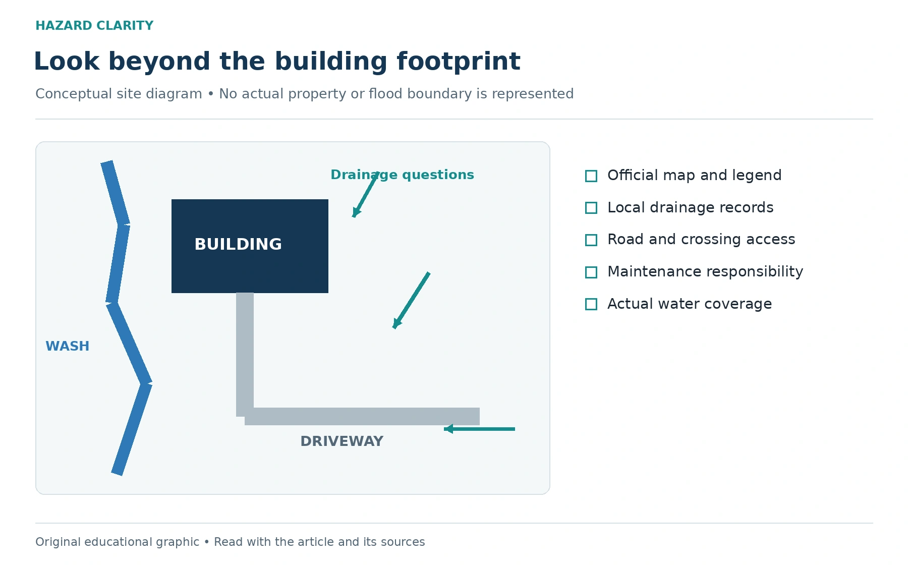
An Arizona property can look dry during a showing and still need careful drainage research. A wash, a low driveway crossing, or a landscaped yard tells only part of the story. Before buying, ask how water moves through the surrounding area, what official records apply, and whether the home’s access or site improvements create questions for a qualified professional.
The useful approach combines map research, local information, physical evaluation, and insurance review. Each contributes something different. A flood-zone label cannot explain every yard-drainage issue, and a clean walkthrough cannot establish how the property behaves during a storm. You are assembling a record of what is known and what needs confirmation.
Start with Hazard Clarity’s Arizona flood information for context. Then use official state and local resources for the actual parcel. This guide focuses on washes, access, and existing drainage features, rather than trying to turn a dry-day photograph into a flood determination.
Understand why a wash deserves a question
A wash is a channel that may carry water periodically even when it is dry at other times. Arizona’s official information recognizes washes as part of the watercourse landscape. Its presence near a property should lead to research about the actual setting, not an automatic decision to reject or accept the home.
Ask where the channel is relative to the parcel, structures, driveway, and roads. An address marker on a map may be distant from the building or access route. Save enough geographic context to show what you are investigating. If the parcel is large, identify which part is relevant to the purchase question.
Do not walk into a wash during hazardous conditions or wait for flooding to observe its behavior. A buyer’s research can use records, appropriate professional evaluation, and safe observations. The goal is to understand the property before a storm, not gather dramatic photos during one. Active weather and road decisions should follow current official instructions.
Use the official map with its legend
Begin the map review with FEMA’s effective flood information and relevant local resources. Record the source, date, panel or layer, and legend. Keep the full context when saving a screenshot. A colored shape without its explanation is difficult to interpret and easy to misstate later.
HC’s guide to checking a FEMA flood zone explains the broader process. For the Arizona property, ask the local floodplain administrator which records apply and whether additional drainage information is available. Arizona’s Department of Water Resources supports local floodplain management; local offices are important points of contact for parcel questions.
A lower mapped flood designation does not establish that every form of flooding is absent. Similarly, a mapped floodplain does not identify every condition inside a building. Separate the official designation from questions about site runoff, structural openings, and road access. They may require different records and different professionals.
Review the access route as well as the home
A building and its driveway can have different relationships to moving water. Ask how the property is reached and whether the ordinary route includes low crossings, washes, or other locations where water may affect access. This is especially useful when the road network offers few alternatives.
Request any available road-maintenance information from the relevant authority or responsible association. Ask about public and private sections, known closure procedures, and the location of official condition updates. An owner’s recollection is helpful background, but it should not be presented as a permanent guarantee of access.
Arizona transportation guidance warns against entering flooded roadways. Use that principle in your ownership plan and follow actual closures and instructions. A vehicle’s size is not an exemption. During purchase research, the practical question is how to get reliable access information and plan alternatives, not how much water a vehicle might cross.
Ask what changed on the lot
A yard may contain block walls, grading, patios, drains, or landscaping that affect the questions a site professional will ask. Request records for substantial changes and find out who completed the work. The fact that an improvement looks tidy does not show how it was designed or whether applicable approvals were obtained.
Ask specifically about the purpose of drainage features. Where is water intended to go? What area does the feature serve? Who maintains it? A visible inlet or pipe may lead somewhere you cannot see, and its existence does not prove it has the capacity or condition needed for the site.
Do not propose removing a wall, filling a channel, or redirecting runoff based on a showing. Such work can involve neighboring properties and local requirements. Ask the appropriate authority and a qualified design professional before treating a modification as simple. For the purchase, define the question and request the records first.
Read easements and responsibilities carefully
A drainage feature may involve an easement or an area with maintenance responsibilities. Ask your title and transaction advisers to identify relevant documents and explain what they mean for the property. A line on a survey or an entry in a title commitment may need more context before you understand its practical effect.
Request the actual recorded document where appropriate. Keep the legal description and any drawing together rather than interpreting a short label on its own. If an association maintains part of the drainage system, ask for the governing information and a contact who can explain current responsibilities.
This is a question about rights, duties, and use of the land. A hazard report cannot interpret the legal effect of an easement, and a general inspector cannot establish every ownership obligation. The strongest file names the source and the adviser responsible for explaining it. Keep unresolved legal questions visible until that explanation arrives.
Ask the seller for a water history
Request available information about water entry, yard flooding, drainage work, and access interruptions. Ask for dates, locations, photographs, invoices, and professional reports where they exist. A precise account is more useful than a broad statement that the property has never had “a problem.”
Separate different events. Water pooling in a yard, entering a structure, and making a road impassable are different observations. They may relate to different mechanisms or parts of the property. Record the details without assuming one explains another. If work followed an event, request its scope and any later evaluation.
Missing records are an uncertainty, not proof that an event did or did not occur. Your REALTOR can help request information through the transaction, while legal questions about disclosures belong with an appropriate adviser. Use the available history to prepare better inspection questions rather than trying to settle every technical issue through seller recollection.
Define the physical review you need
Tell the general inspector which drainage and water questions you have identified. Ask what visible site and building features are included in the agreed service and what requires specialist evaluation. If there is a concern about grading, channel behavior, or a drainage design, ask which qualified professional should address it.
Share the map and seller records with that professional. A report that identifies the actual question and its limitations is more useful than a general reassurance. Ask what was observed, what was inferred, and whether additional survey information, calculations, or records are needed before a conclusion can be reached.
Do not assume a dry-day inspection reproduces storm conditions. The inspection may provide valuable observations without establishing the result of every future event. Keep its scope attached to the finding. When comparing houses, use the same categories so one property’s detailed review is not compared with another property’s unverified description.
Review flood and other water coverage separately
Ask a licensed insurance professional how the proposed policies treat the water scenarios relevant to the home. HC’s flood-coverage explanation can help you prepare, but the actual policy wording controls the coverage discussion. Do not assume every water-related loss falls into the same category.
Provide the property details accurately and disclose information requested by the insurer. If you have a documented drainage concern, ask how it relates to the proposed coverage and any requirements. Keep the response with the proposal rather than relying on a casual statement that you are “covered for water.”
Ask about limits, deductibles, effective dates, exclusions, and any relevant waiting period. Do not treat a quote as evidence that coverage has started. The purchase timeline and the policy timeline need to work together. Your insurance professional can explain the applicable options and what must be completed for protection to be in place.
Build a useful dry-day showing checklist
During a showing, record the location of visible drains, low areas, walls, driveway crossings, and any water-related staining you can observe safely. Describe what you see without assigning a cause. A photo can document a feature, but it cannot prove why it exists or whether it is functioning correctly.
Ask which observations deserve follow-up. For example, a hypothetical buyer might notice a drain near a patio and learn that it was added after water pooled there. The next step is to request the installation history and a qualified evaluation, not assume that the drain either solved everything or failed.
Keep the checklist short enough to use. Give each item an observation, source, next question, responsible person, and deadline. Place uncertain items in an unresolved column. This creates a clearer conversation with the inspector and the seller and prevents a memorable visual detail from becoming an unsupported property judgment.
Make the final review about evidence
Before making your final transaction decisions, assemble the official map context, local responses, seller history, physical findings, title questions, and insurance proposal. Check whether the records describe the same parcel and current building. A mix of addresses or outdated project details can make a complete-looking file misleading.
Discuss remaining uncertainties with the professionals responsible for them. Some questions may be answered quickly; others may require more time or a different service. Your REALTOR or attorney can explain contractual options. The decision should reflect the evidence and your ability to manage ownership responsibilities, rather than the confidence of an informal remark.
Run the address through Hazard Clarity to organize the location review. Then follow the water questions beyond the address marker: the wash, the lot, the access route, and the proposed coverage. A useful Arizona purchase file makes those relationships clearer and leaves you with a practical plan for what to verify next.
Sources and reference material
Arizona Department of Water Resources Floodplain Management Overview • State support for local floodplain management. Accessed October 2 2026.
Arizona Legislature ARS 48 3601 Definitions • Washes within the statutory watercourse definition; no legal determination for a parcel. Accessed October 2 2026.
Arizona Department of Transportation When You See a Flooded Intersection Turn Around • Flooded roadway avoidance; August 10 2021 background guidance. Accessed October 2 2026.
See this property’s own hazard picture.
Check an address